React faster, work smarter
MX is a unified platform for large-scale operational management — connecting teams, assets, jobs, and data across the real world.
From disaster recovery to infrastructure coordination, MX helps organisations plan smarter, respond faster, and maintain total control — all from one intuitive fully customizable system.
Coordinate and Automate your Operations with the MX Platform
The 5 Elements of MX
The 5 key ‘building blocks’ of MX – Asset, Work, Workforce, Spatial, and Mobility, work together to provide a coherent and flexible platform that can be rapidly deployed and configured in most operational scenarios. The rapid deployment features make it particularly suitable for fast moving and unpredictable operational situations where a traditional work management or enterprise asset management (EAM) product may struggle.
The 5 main components are enhanced by supporting technologies for Business Intelligence (BI), and Artificial Intelligence (AI), providing hooks to utilize the data generated in each of the components to provide meaningful dashboards and reports as well as machine learning-based insights and pattern recognition.
Asset
Asset management ensures critical resources are available, visible, and ready to deploy. MX provides real-time tracking of asset status, locations, condition and maintenance, supporting faster and smarter decisions. Tools like GPS, RFID, and barcoding enable automated inventory control and asset tracking. A full asset history provides the means to think smarter about your assets.
Work
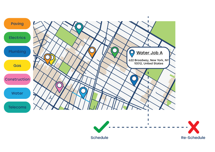
MX enables the flexible, centralised control of tasks, resources, and communication, supporting auto-allocation and dispatch across a mobile-enabled workforce. MX supports the definition of standard work templates ensuring consistency in application over time, while allowing the flexibility of ad hoc activities to be allocated, dispatched and monitored in real-time. The platform pulls together work type, assets, and locations allowing analysis of work done from multiple viewpoints.
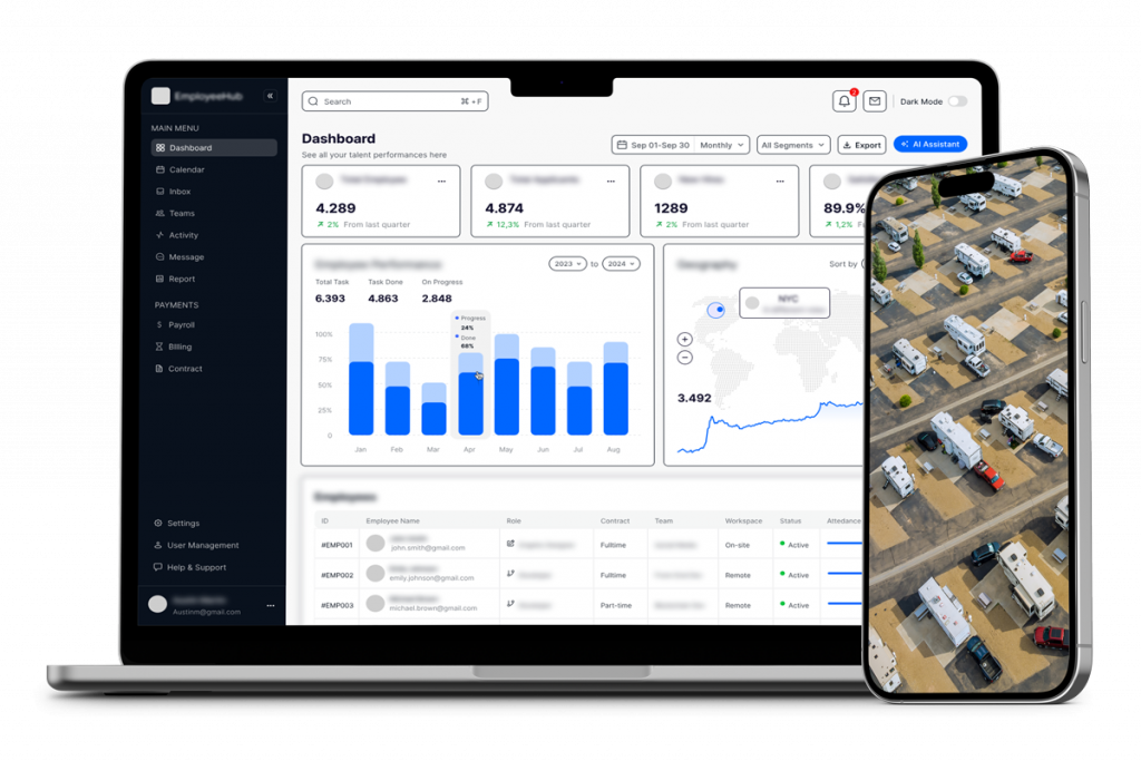
Workforce
MX provides tools for managing training, credentials, and readiness, for both in-house and 3rd party contractor personnel. The tracking of training records and certifications ensures that all personnel are fully qualified and prepared for your mission, whether it is role-specific skills, health and safety, or security, from day one. By automating admin and maintaining detailed records, MX supports not just a compliant and skilled workforce, but a safe and secure working environment.
Geospatial
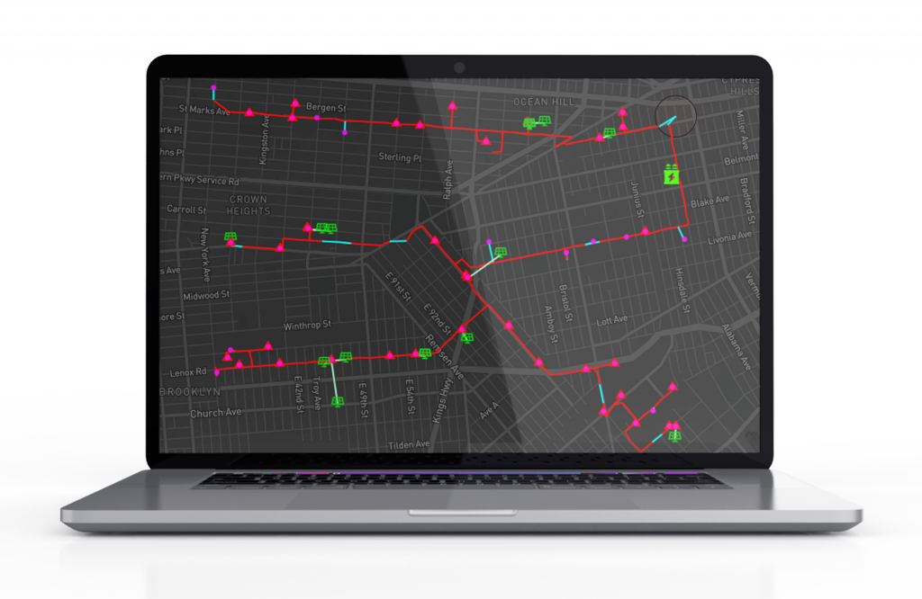
Nothing beats a well designed map for presenting data with a spatial component, and providing the user with a visually direct level of situational awareness. MX: spatial integrates GIS into emergency operations, layering complex data into a single, clear operational map usually updating in real-time. The generated maps can incorporate intrinsic work/location/asset/crew data from MX overlaid with 3rd party static or dynamic maps such as weather feeds. The spatial platform can be utilized in many scenarios ranging from routing, crew tracking, to operational dashboards.
Mobility
Mobile capabilities are crucial in emergencies in where speed, coordination, and remote access to information matter. The MX+ app supports real-time communication, GPS tracking, work order dispatch, and real-time updates from the field. MX+ supports offline field data capture, and users complete inspections without connectivity, with intelligent syncing when service returns.
Importantly, configuration updates, including changes to data collection forms and workflows can be delivered over-the-air (OTA) without forcing the crews to return to base.
Coordinate and Automate your Operations with the MX Platform
One Platform. Every Operation. Total Clarity.
City Operations
Give city departments a unified system to manage work orders, assets, crews, and cost centres across infrastructure, utilities, and public spaces.
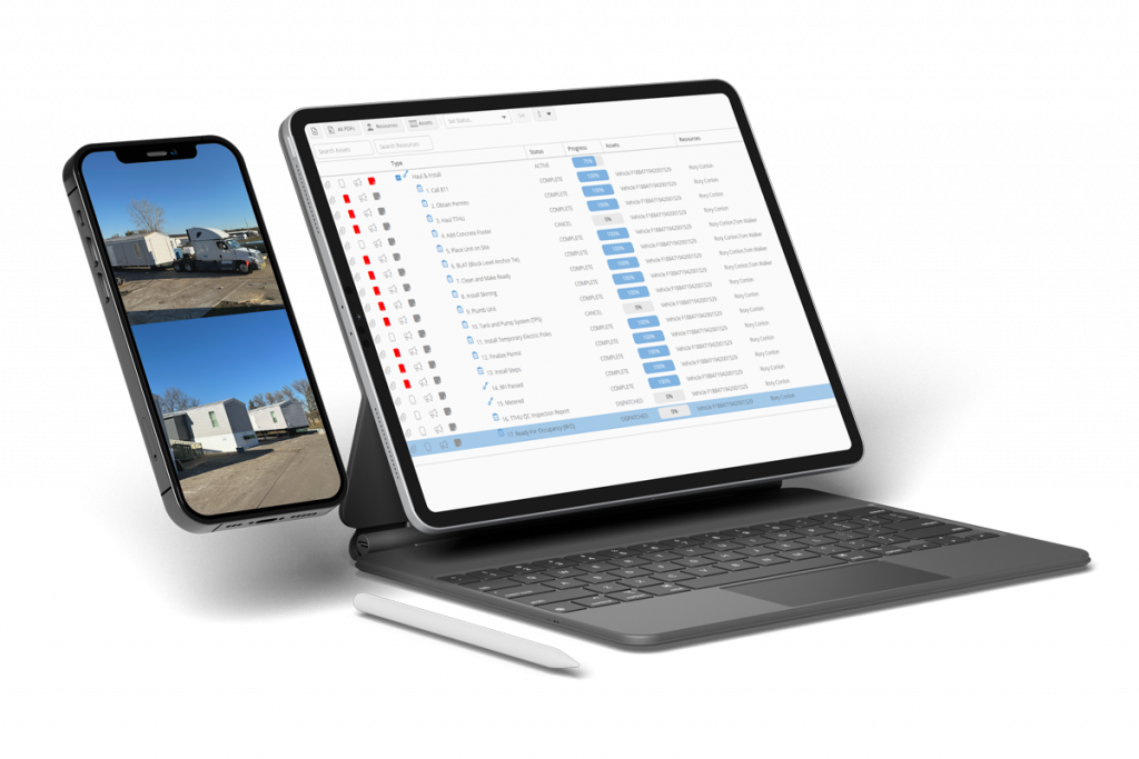
Temporary Housing
From site inspections and haul-and-install operations to ongoing maintenance through to deactivation.
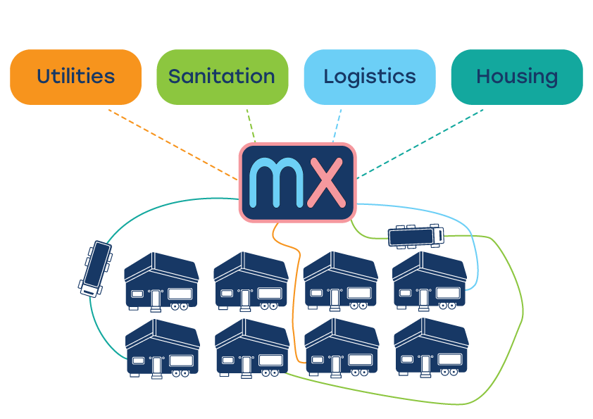
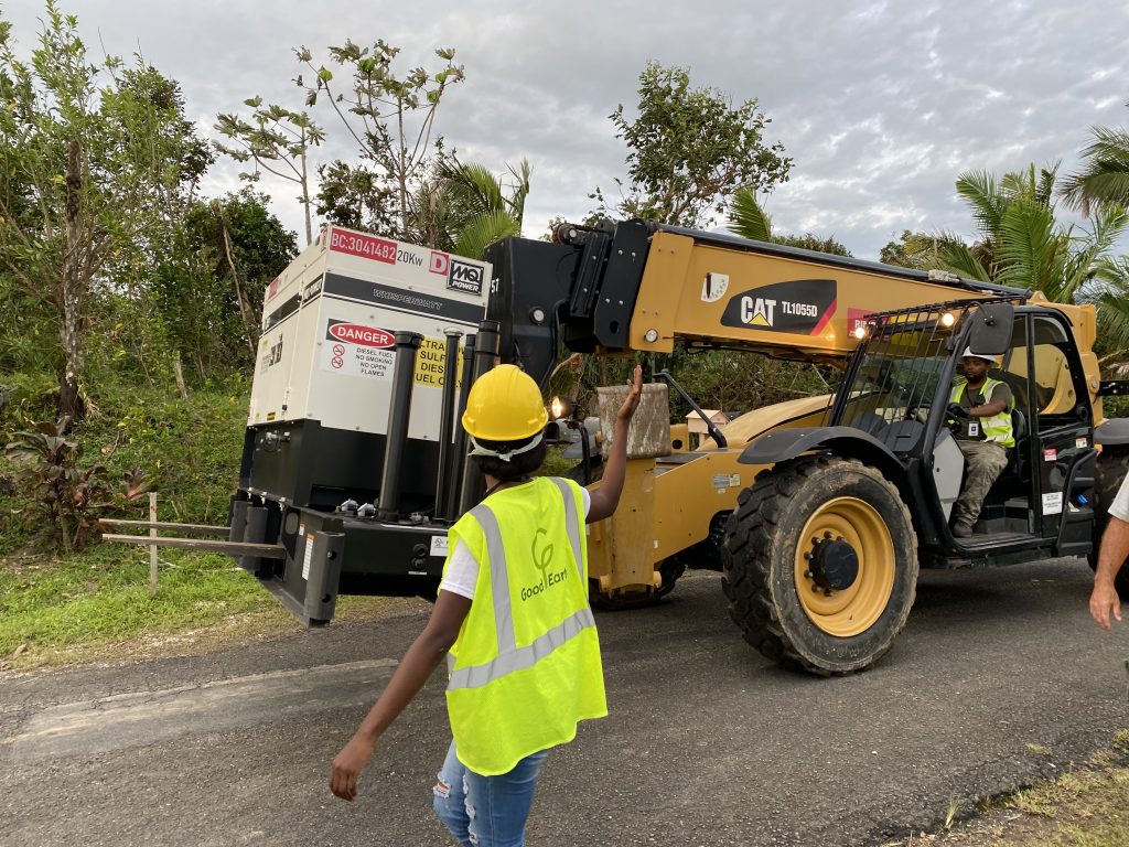
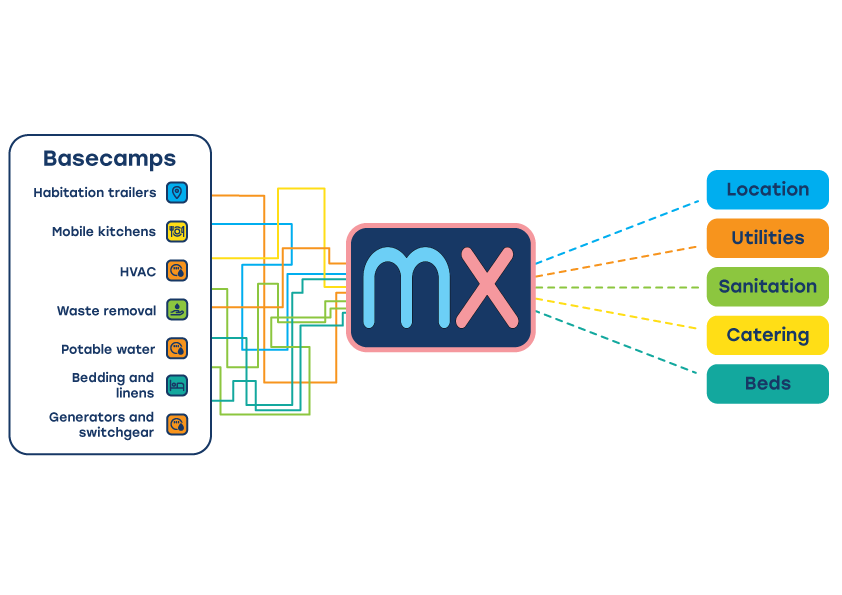
Base Camp
Bring structure and speed to base camp operations by tracking billeting, catering, power, and sanitation assets in a single dashboard-oriented system.
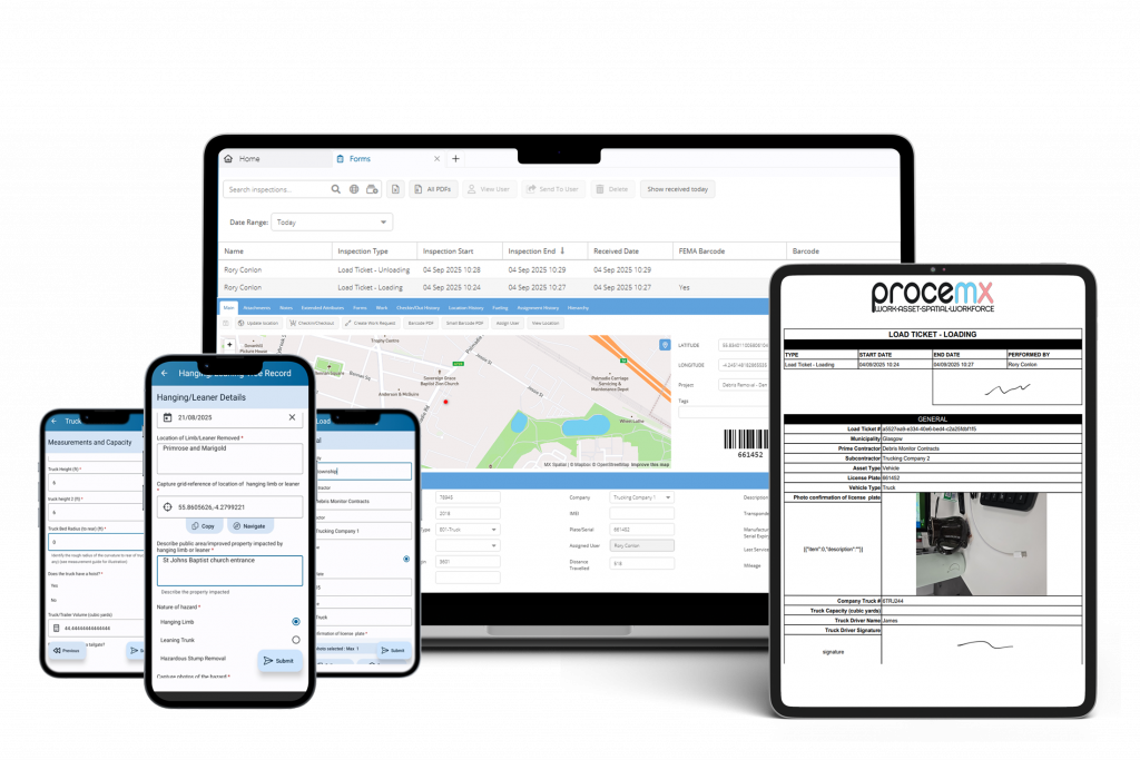
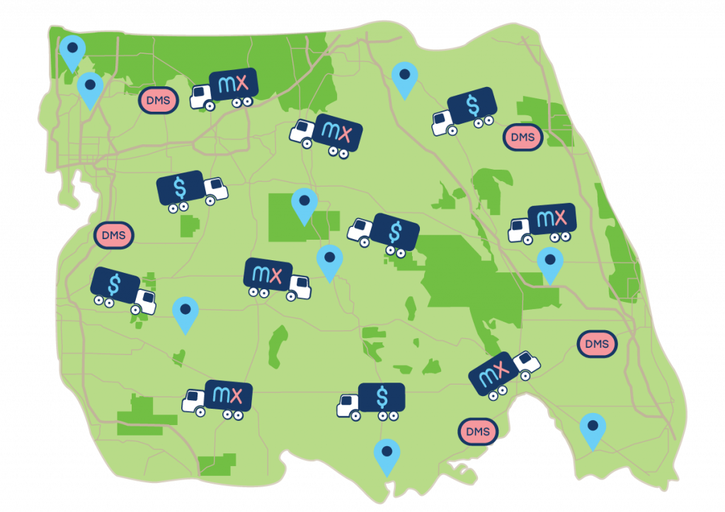
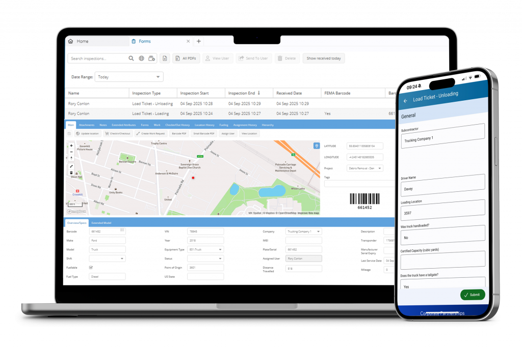
Debris Operations
Streamline disaster debris operations with geotagged load ticketing and accounting, DMS monitoring, and auto-updated reports and debris maps.
City Operations
Give city departments a unified system to manage work orders, assets, crews, and cost centres across infrastructure, utilities, and public spaces.
Temporary Housing
From site inspections and haul-and-install operations to ongoing maintenance through to deactivation.
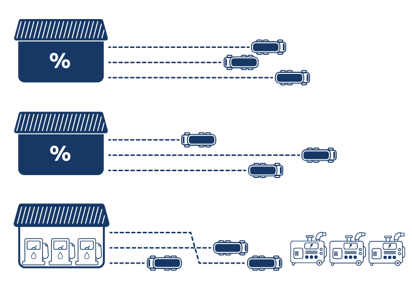
Logistics
A control tower for state and federal logistics — tracking assets, inventory, and vehicles from Vendors to LSAs to PoDs (Points of Distribution).
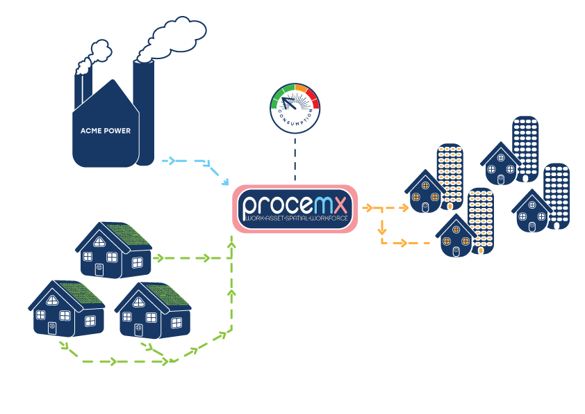
Renewables
Coordinate grid integration, real-time visibility of renewable assets, grid interconnection readiness, and supporting Distributed Energy Markets.
Debris Operations
Streamline disaster debris operations with geotagged load ticketing and accounting, DMS monitoring, and auto-updated reports and debris maps.
Logistics
A control tower for state and federal logistics — tracking assets, inventory, and vehicles from Vendors to LSAs to PoDs (Points of Distribution).
Renewables
Coordinate grid integration, real-time visibility of renewable assets, grid interconnection readiness, and supporting Distributed Energy Markets.
Operational Software Built for the Real World
MX integrates thousands of moving parts — people, processes, assets, and data — into a single operating picture. Designed for high-pressure environments and complex logistics, the platform supports:
Create, assign, and track work in real time — across teams, regions, and contractors
Manage everything from vehicles and equipment to housing units with full work and location history
Visualize MX-sourced and 3rd party geo-tagged data in a single geospatial view to provide a unified picture that is more than the sum of its parts
Make your crews 'mobile-capable' and enhance data quality as well as minimizing latency in building a picture of field operations
Dashboards and audit trails provide full transparency — from financial reimbursements to work order completion time metrics
Start simply.
Configure Everything.
Our software has been at the heart of emergency disaster response in the USA for over 20 years. We’ve helped agencies and state leadership gain full end-to-end visibility on what’s logged, what needs done, when it’s been done and the financials at every step of the way.